
Catchment & Flooding
Gayndah is part of the Burnett Catchment. Located on the Burnett River, the town is approx 45km downstream from where the Boyne & Auburn Rivers join, and approx 60km upstream from where the river runs into Paradise Dam.
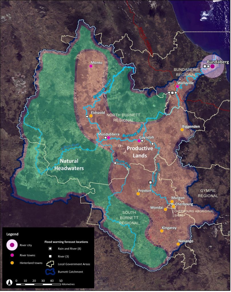
Catchment Area
The Burnett River begins in the Dawes Ranges, (north of Monto), then flows through Eidsvold, Mundubbera, Gayndah, into the Paradise Dam, before moving through to Bundaberg and past Burnett Heads where it meets the Pacific Ocean.
The rivers of Nogo, Auburn, Boyne and the Barker-Barambah Creek system all feed into the Burnett river along the way. Feeding the river with rain from the North Burnett, South Burnett, and Bundaberg regions.
History of Flooding in Gayndah
The Burnett River at Gayndah is a deep incised channel, approximately 20 m deep and 250 m wide. Flood impacts to Gayndah experienced in the in 1942 & 2013 floods, also included a backflow of floodwater from Oaky Creek and Sauers Gully to the south, and Reid Creek to the north.
26 Jan 2013 – 1 in 100 to a 1 in 200 year event
6 Jan 2011 – 1 in 20 year event
28 Dec 2010 – 1 in 15 year event
23 Dec 2010 – 1 in 15 year event
7 Feb 2003 – 1 in 10 year event
1996 – 1 in 10 year event
Feb 1942 – 1 in 55 year event
Dec 1921 – According to the Brisbane Courier in Trove, the original Gayndah Bridge was reported as 15ft under water.